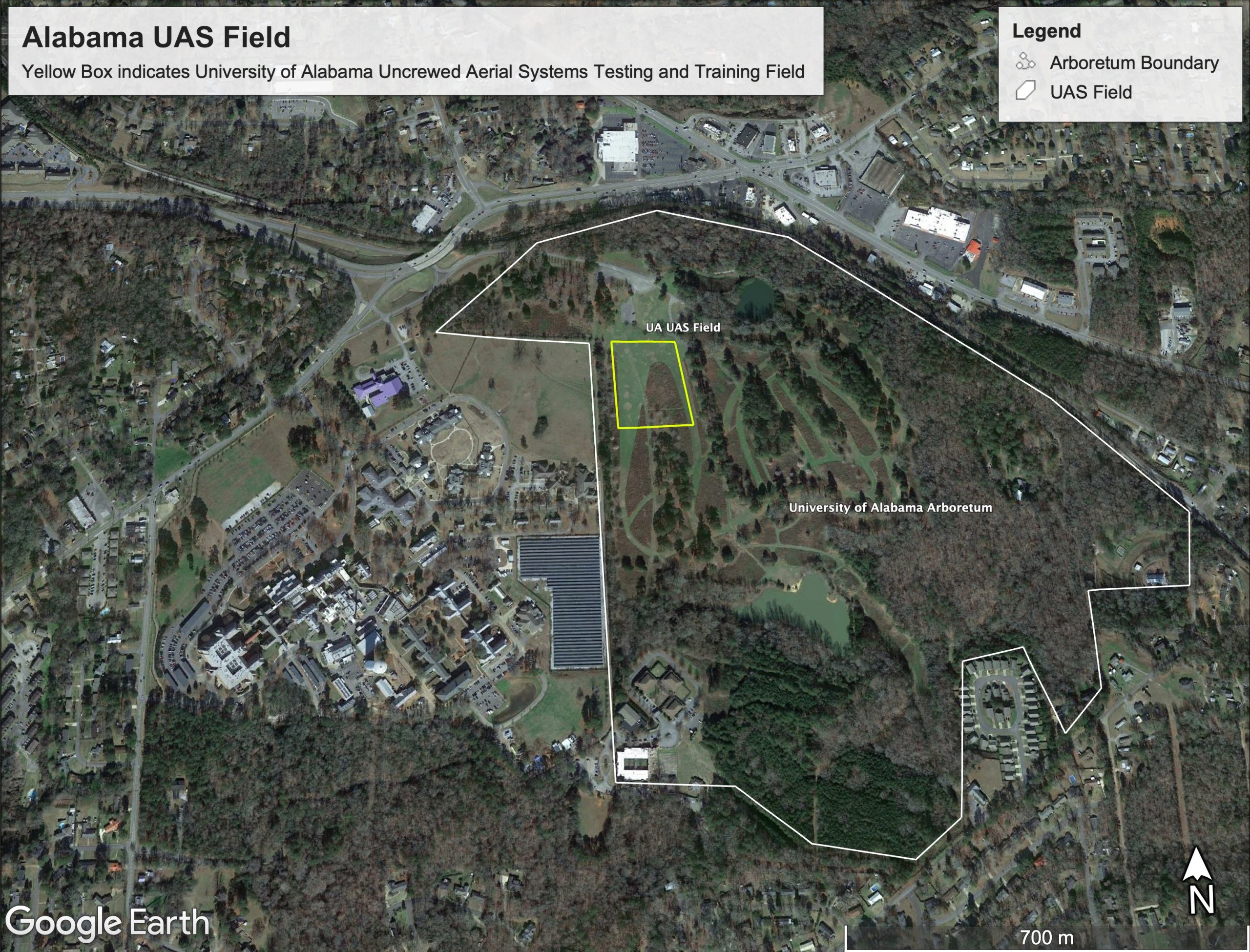
UAS Field Map
The Department of Geography and the Environment has established a UAS testing and training field for the safe and lawful operation of University-owned or affiliated UAS by faculty, staff, and students who are in compliance with UA’s UAS Policy. The field is located within the UA Arboretum property (see map). Those wishing to use the field should first consult the UA Office of Compliance, Ethics and Regulatory Affairs, Unmanned Aircraft Systems webpage
Please note: Use of the field without an approved UAS request form is not permitted at the UAS field or anywhere on the UA campus.
The Geography Department currently has five T/TT faculty and multiple students who use UAS in their funded research. We also teach a variety of UAS and remote sensing courses reliant on UAS-based remote sensing products.
UAS courses include:
GY 422/522 Introduction to UAS
GY 426/526 UAS Applications
GY 427/527 UAS Data Processing
see GY catalog page for course descriptions